Home > Our Offer > NavVis VLX – point cloud with 6 mm accuracy for today? Only in SCAN3D

NavVis VLX – point cloud with 6 mm accuracy for today? Only in SCAN3D


We are the first in Poland to offer comprehensive services of 3D mobile scanning using the NavVis VLX scanner. This is a technological revolution, distinguished by the unprecedented speed of mapping large spaces, combined with excellent precision. How does it work? For example, an area of 5 500 m2 will be scanned in less than an hour, and postprocessing will take only 6 hours. You get the point cloud on the same day. What else will you get?

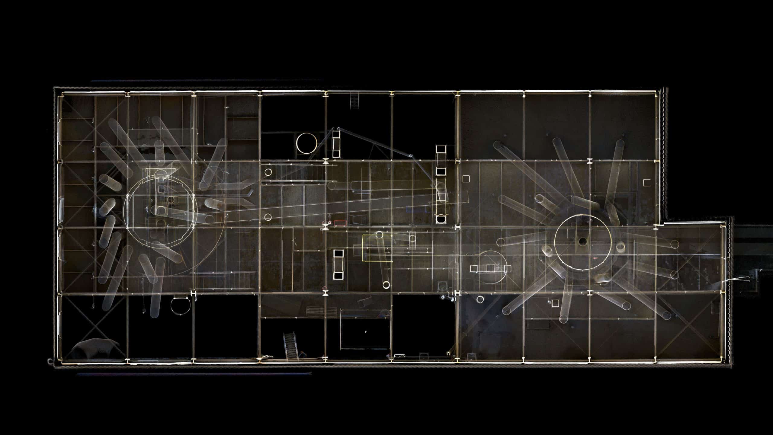
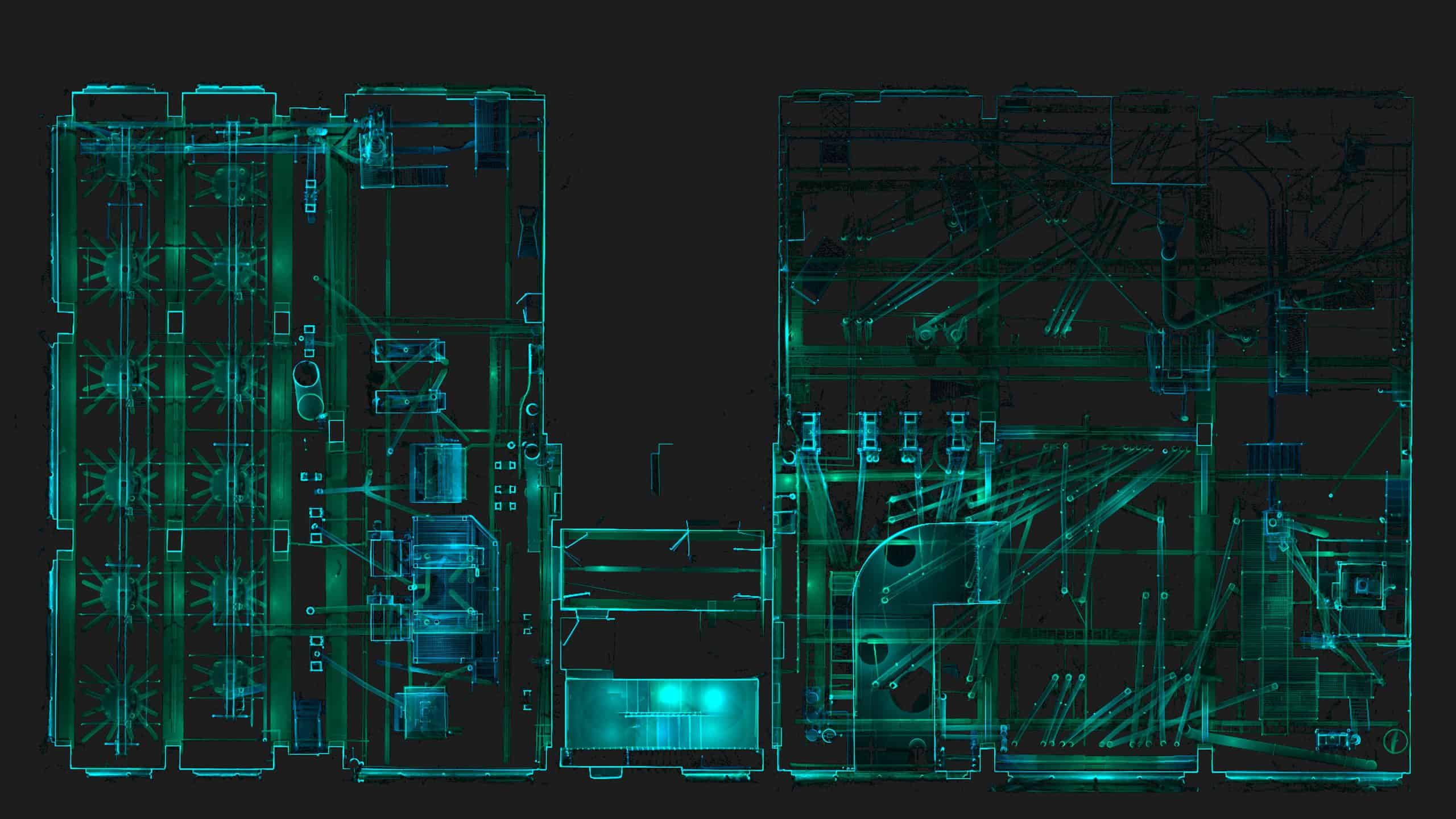
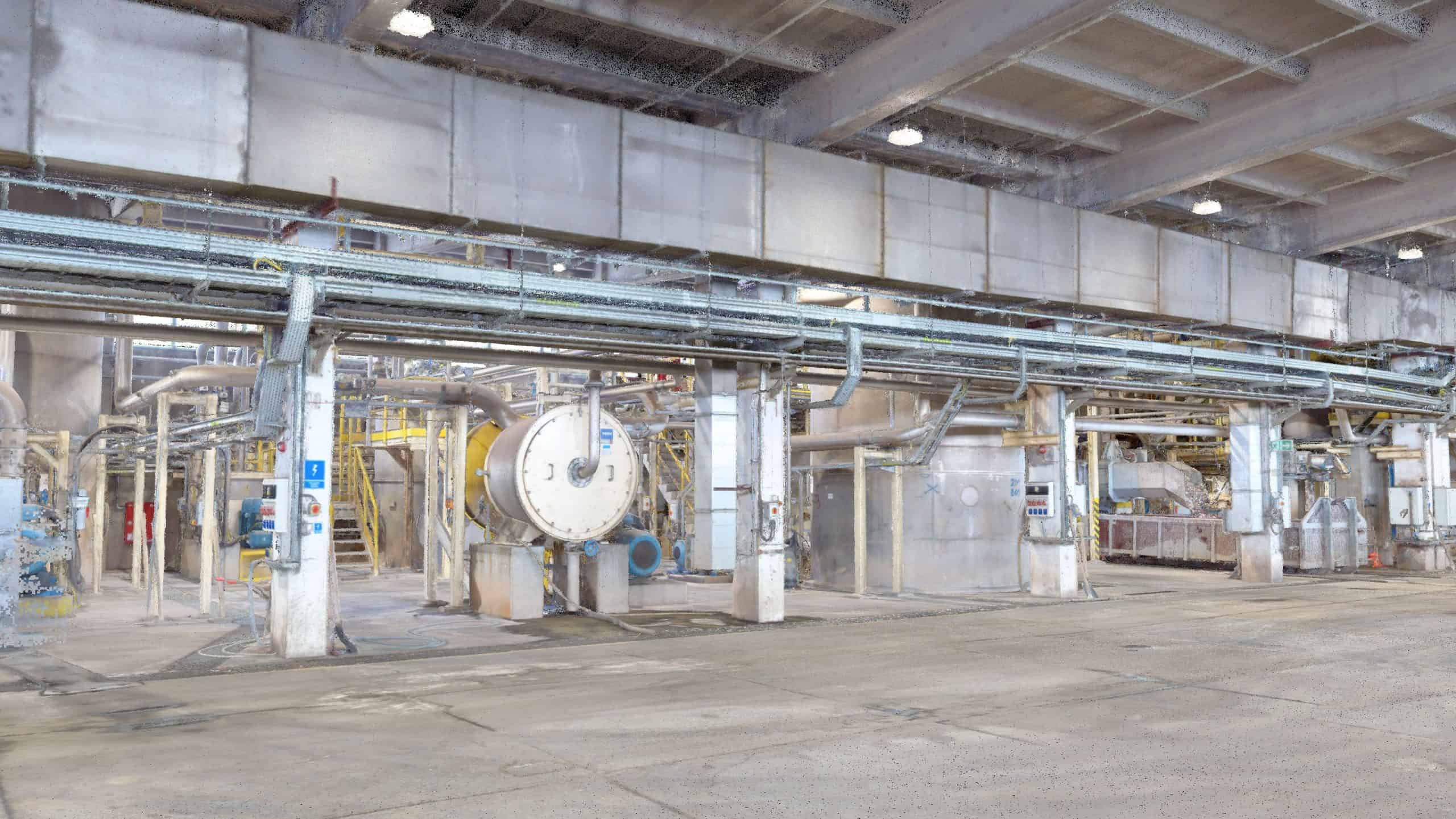
NavVis VLX – technology description

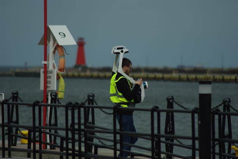
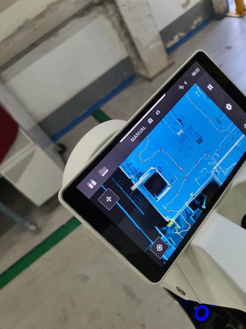
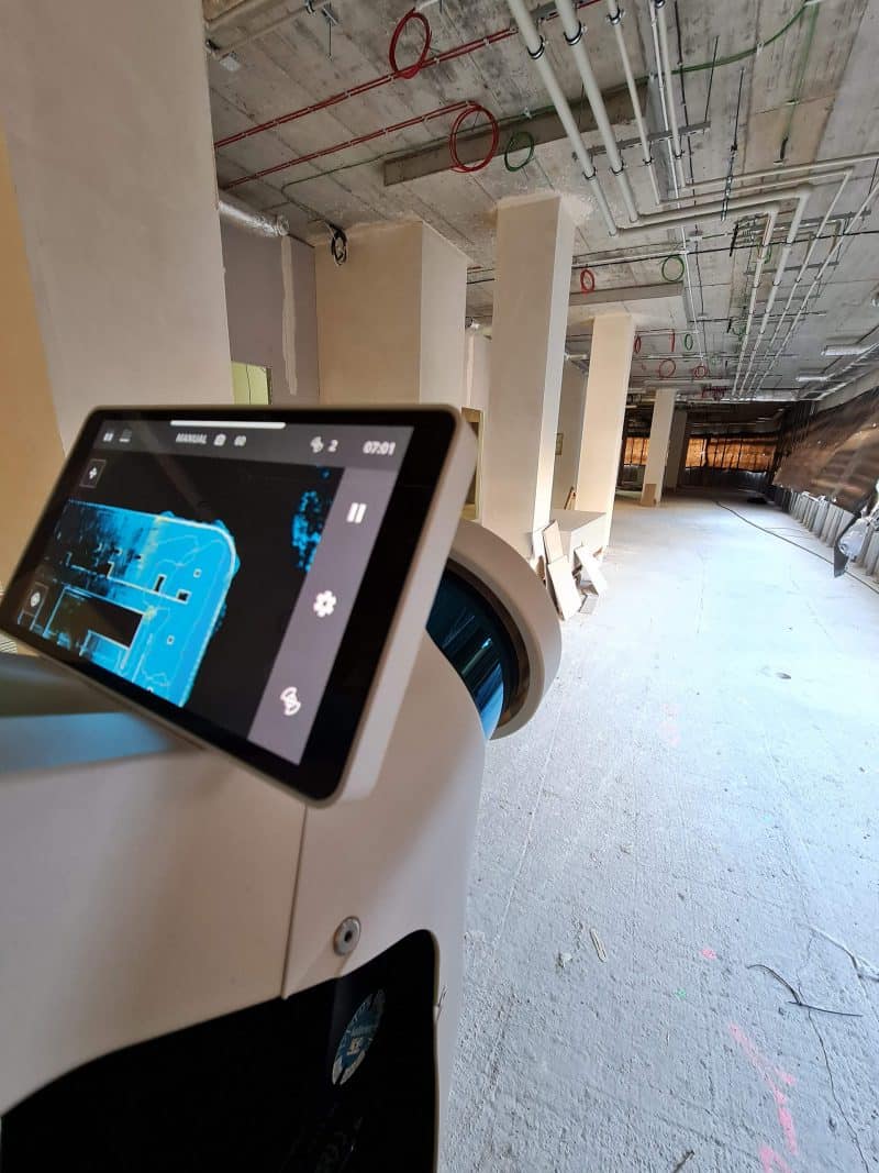
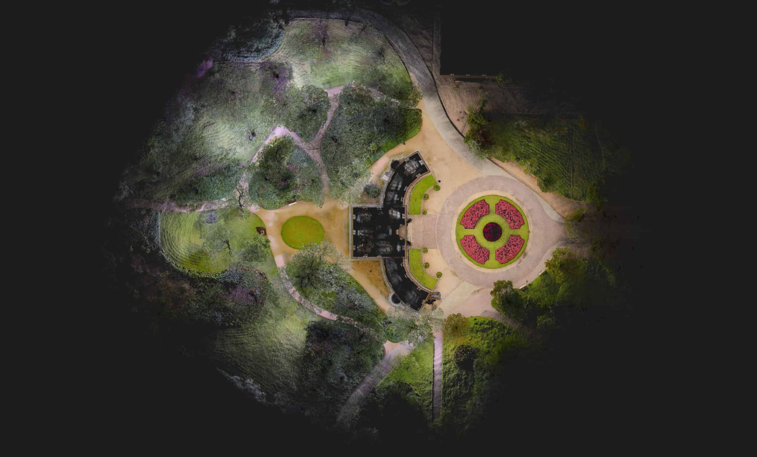
NavVis VLX is a mobile 3D laser scanner created by a German company named NavVis – a world leader in mobile scanning technology. It is the ideal solution for investments where the speed of data acquisition is a key element of success. The device records geometric data from the environment and the trajectory of the device’s movement, based on 2 laser scanners and the SLAM algorithm. The resulting point cloud achieves an accuracy of a few millimetres. Thanks to 4 cameras built into the NavVis VLX scanner we can also acquire photos, which are used to colour the cloud and create 360o panoramas, that we use in virtual walks.

Mobile scanning with NavVis VLX – scanner characteristics

  • 2 laser scanners with optimal locations for precise data acquisition (one above the head, one at chest height).
  • Range: 100 meters.
  • 3D scanning capacity: 1 500 – 3 000 m2 per hour.
  • Distance measurement error: 6 mm.
  • Built-in 4 cameras of 20 Mpix – allow you to generate panoramas with a resolution of up to 33.5 Mpix RGB.

NavVis VLX vs stationary scanners

The main advantage of the mobile scanner is the perfect ratio of the quality of the acquired data to the time of their collection, which significantly reduces the cost of the entire operation. Compared to the stationary scanners, the speed and comparable precision of the NavVis VLX mobile scanner compensate for the lower resolution and operating range of the device.

Faro scanner and others:

  • Range: 70 – 350m.
  • 3D scanning capacity: 800 – 1 500 m2 per day.
  • Distance measurement error: ± 1 mm.
  • Resolution up to 165 Mpix RGB.

We combine technologies and tools for your investment

NavVis IVION Platform


The NavVis IVION Platform is a perfect complement to the NAvVis mobile scanning system. This tool is designed for the distribution of data obtained in the scanning process., as well as browsing and management of collected data. IVION platform allows you to create virtual walks enriched by “non-geometric” data – hotspots with descriptions, instructions or tips. NavVis IVION also enables navigation inside objects.

Stationary scanners, photogrammetry and surveying


In the process of creating Digital Twins, the most important thing is the effective combination of various technologies.  At SCAN3D, we use our extensive hardware resources – drones, stationary scanners and cameras. If necessary, we also use traditional measurements. Thank to all above, we can take up any challenge.

Where will you apply it? How will you benefit?

The NavVis VLX scanner is a device recommended for:

  • Collection of geometric data (point cloud).
  • 3D BIM modelling.
  • Creating virtual walks.
  • Navigation inside the building.

Thanks to its efficiency, NavVis VLX is perfect for facilities, where registered status is short-term (advancement of the progress of construction site, measurement of disappearing works, crisis situations, emergency states, etc.). In our portfolio, you will find projects related to:

  • Inventory of large spaces (parks, streets, city centre, shopping centres).
  • visualization prepared for the modernization of industrial and service buildings,
  • verification of ready 3D models for a given investment,
  • inspection of the construction status,
  • elaboration of data for facility management within the digital factory.

Need a quick scan?

Nothing could be easier! Write to us and we will help you with your project!

Contact us