What is the process to most effectively use a huge amount of data that we acquire during 3D laser scanning? How to use it to prepare 2D documentation out of spatial data?
Architectural Documentation from 3D Scanning
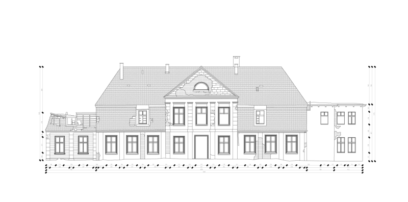
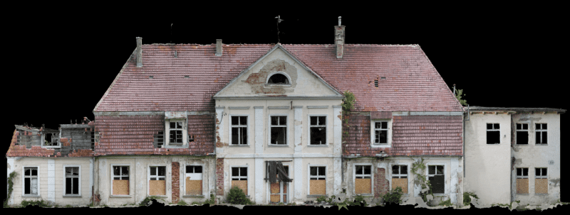
Architectural documentation from 3D scanning is a tool more and more commonly used by investors in design work. We can develop it from a point cloud or a 3D model. It saves a lot of time spent on traditional data acquisition. 3D scanning or 3D model guarantees the precision of measurements and obtaining comprehensive information that is easy to process further. You will use it in the creation of design and as-built documentation. You can use it to draw projections, sections, drawings of structural elements, complex facades or other details. It will simplify the archiving and inventory of geometry during modernization. Check the possibilities in SCAN3D.
Architectural 2D documentation – data acquisition.
1
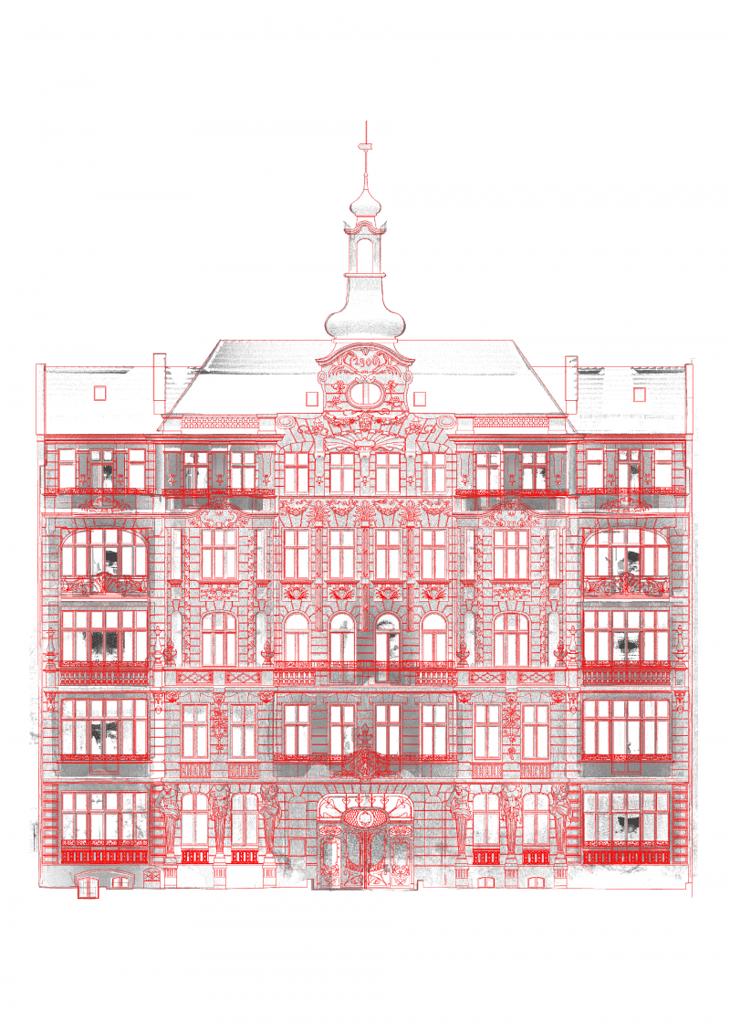
Processing from point cloud
If 2D documentation is created based on the point cloud, meaning without making a 3D model first, it always will be a “compromise” product. We will prepare simplified information from the point cloud (cross-section at a given level, projections, outlines, etc.) in a planar drawing independently for each cut location. If a given project requires generating a large amount of data, the order execution time in this technology may be longer.
2
Processing from 3D model
Working on a previously prepared 3D model, we are free to choose the places of cuts. Anything, that was modelled, can be presented in any number of 2D drawings. In our 3D model, we can also include “non-geometric” information – descriptions that may be important in the later design process.
Architectural 2D documentation - optimal range of services
Technology that we use on a daily basis gives us a wide range of possible solutions. Therefore, we can respond to the diverse needs of investors and designers. In case of processing Architectural documentation of buildings, we suggest the following solutions:
- Performing necessary measurements by SCAN3D with the use of 3D laser scanning, photogrammetry and ground-penetrating radar.
- Developing 3D models in the field of construction and architecture, as well as the arrangement of MEP and HVAC installations and devices.
- Generating 2D drawings based on 3D models.
- Extraction of 2D drawings for facades and complex details as a supplement to the developed documentation.
Technical documentation – how else will you use the data?
3D scanning is a great tool to develop architectural documentation of newly built or historical objects. You can also use it to prepare other databases such as:
- Conservation documentation.
- Industrial objects layout.
- Updating geodetic map with underground infrastructure.
- Land levelling.
- Prefabrication documentation.
- Spatial data: verticality of objects, deflections, deformations.
What final products will you order from us?
Each time, before our work really begins, we consult and arrange with the client the required level of detail for final products. This data is necessary to determine valuation and deadline for the project. What formats do we provide?
- Architectural 2D documentation is provided in DWG and PDF formats.
- Development in 3D, according to the customer’s request, we can provide additionally:
- 3D BIM model – Revit, IFC, ArchiCAD, Cadmatic, PDMS.
- 3D MESH model – OBJ, PLY, STL.
- 3D model – DWG.
- Point Cloud.
Use 3D scanning to create architectural documentation of your own investment.
Contact us and we will choose together the best option for you.
Contact us